
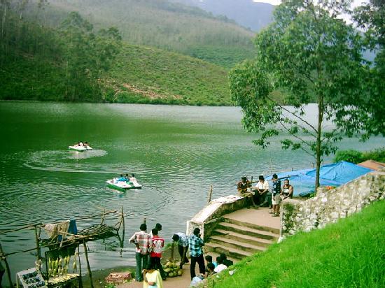
Echo Point
Historical & Geographical Context
While Echo Point is famous today as an interactive natural attraction, its background is deeply intertwined with Munnar’s colonial history and mid-20th-century infrastructure development.
1. The Colonial Tea Estate Era
During the late 19th and early 20th centuries, Munnar was transformed by British plantation owners into a massive hub for tea, coffee, and spice cultivation. The route passing through Echo Point leading up to Top Station (the highest point in the area) served as a vital transit corridor. Top Station hosted the uppermost railway station in the Kundala Valley, where tea leaves were transported via monorail and cableways down into the plains. Local estate workers and travelers frequently stopped along this route, informally discovering the unique acoustic properties of the natural valley basin.
2. The Confluence of Three Mountain Ranges
Geographically, Echo Point is situated at the precise meeting point of three major South Indian mountain ranges: Mudrapuzha, Nallathanni, and Kundala. The unique layout of these steep, mist-shrouded rock faces creates a perfect natural amphitheater. When sound waves travel across the open lake water, they strike the hard, forested ravines of these converging peaks and reflect cleanly back to the source.
3. The Hydroelectric Boom
In the late 1940s and early 1950s, the construction of nearby Mattupetty Dam and the reservoir system reshaped the local landscape. The resulting scenic water body on the banks of Echo Point significantly enhanced the location’s visual charm, eventually transforming it from a simple roadside stop into a fully fledged, iconic tourism hotspot in the late 20th century.