
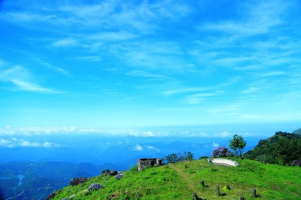
Santhanpara

Santhanpara

Santhanpara is a visually striking, high-altitude village located in the Idukki district of Kerala, nestled along the Munnar-Kumily Highway (NH 85). Known largely for its vast spice plantations and sweeping green slopes, it forms a vital piece of the region’s agricultural heartland.

Historical Context & Background

​1. The Sanctuary of the “Santhals” (Etymology)

​Local lore suggests that the name Santhanpara translates broadly to “The Rock of the Santhals” or “The Rock of the Ascetics”.

  • ​According to regional history, during early waves of migration and clearing, a group of ascetics or distinct tribal travelers (Santhals) found shelter under a massive rock formation in this area while journeying across the Western Ghats.
  • ​The peaceful atmosphere of the location made it a permanent settlement milestone, gradually giving the entire village its name.

​2. The Spice Route & Cardamom Cultivation

​While Munnar town evolved primarily around tea production, the unique microclimate of Santhanpara—characterized by dense shade trees and frequent mist—proved to be a goldmine for Cardamom (Elettaria cardamomum).

​Beginning in the early 20th century, the area became a cornerstone of the Cardamom Hills Reserve (CHR). Farmers from the lower valleys of Tamil Nadu and midlands of Kerala migrated here, turning Santhanpara into one of the top producers of high-quality green cardamom globally.

​3. The Border Culture Synergy

​Historically, Santhanpara shares a close geographical border with Bodinayakanur in Tamil Nadu. This proximity created a unique cultural fusion. For decades, traditional estate labor, spice trade networks, and weekly markets (santhas) relied on ancient mountain passes cutting through the hills. This cross-border exchange heavily influenced the local dialect, architecture, and festivals.

FAQs

Where exactly is Santhanpara and how far is it from Munnar town?
Santhanpara is situated roughly 30 kilometers southeast of Munnar town. It sits at a refreshing altitude of around 1,200 meters (roughly 3,900 feet) above sea level. It is easily accessible via the Munnar-Thekkady route, making it an excellent stopover point between the two popular destinations.
What is the primary tourist attraction located in Santhanpara?
The most prominent attraction is Chaturangapara Viewpoint, located close to the Santhanpara border. Perched on a massive ridge line, it is famous for its powerful wind currents, spectacular sunrise views over the plains of Tamil Nadu, and rows of wind turbines lining the mountain crests. The area is also popular for off-road jeep safaris through organic spice estates.
When is the best time to visit Santhanpara?
The ideal time to visit is from September to March. The post-monsoon months offer perfectly clear views at the viewpoints, lush greenery across the spice valleys, and comfortable temperatures ranging between 15°C and 25°C.
Can tourists visit the spice plantations here?
Yes! Unlike corporate-owned tea estates that have strict access rules, many spice plantations in Santhanpara are privately owned farms that offer guided walks. Visitors can walk underneath the canopy to see how cardamom pods are harvested from the base of the plants and watch the traditional drying process in localized smokehouses (bhattis).
Why is the weather here noticeably windier than Munnar town?
Santhanpara sits directly on a geographical gap along the Western Ghats ridge. As cool air from the high peaks meets the rising hot air currents from the low-lying plains of Tamil Nadu, it generates strong, continuous wind patterns, which is why neighboring ridges like Chaturangapara were selected for large-scale wind energy projects.

Price From : ₹400/-

Address

Near Avaloormadam temple, thathampally po, pin code 688013, Alleppey, Kerala, india