
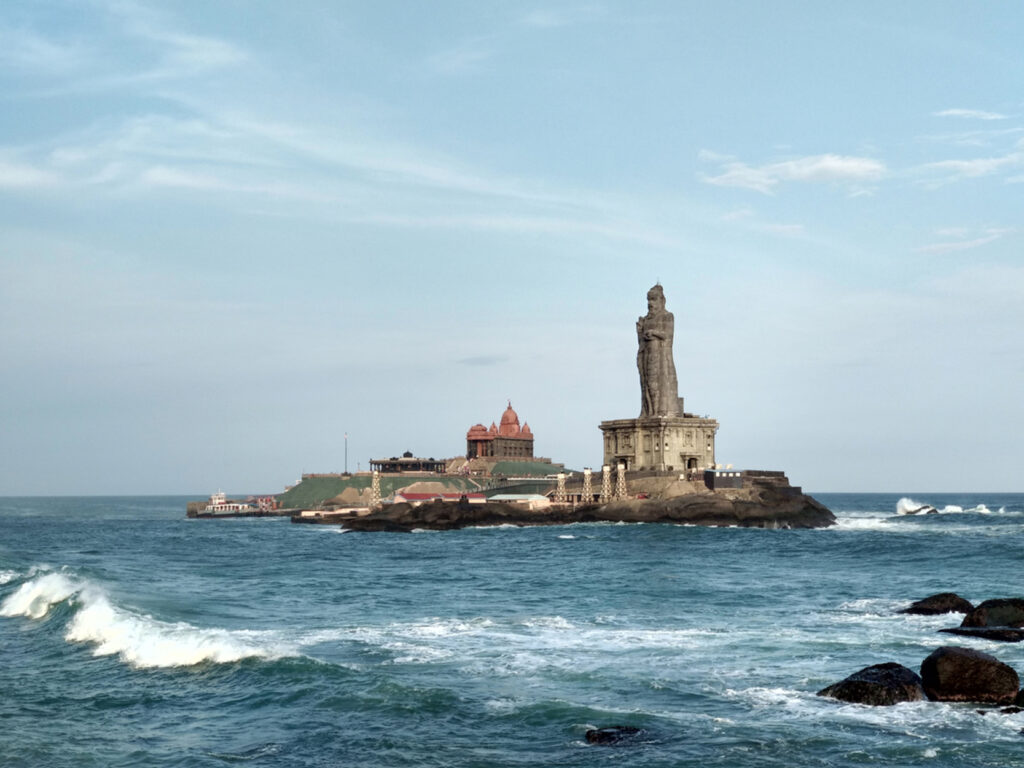
Kanyakumari – Tamilnadu
Located at the southernmost tip of mainland India, Kanyakumari (formerly Cape Comorin) is famous for its unique geography—where the Arabian Sea, Bay of Bengal, and Indian Ocean meet (Triveni Sangam).
📜 Historical Highlights
Ancient Roots & Mythological Legend: Mentions of the region date back to ancient Tamil Sangam literature and Greco-Roman records by Ptolemy. Legend holds that Kanya Devi (an avatar of Goddess Parvati) performed penance here. Uncooked rice from her unfulfilled wedding allegedly turned into the multi-colored sand found on the shore today.
Dynastic Rule: Governed by prominent South Indian dynasties over centuries—including the Cheras, Cholas, Pandyas, Nayaks, and later the Venad/Travancore Kingdom. The region was known as Nanjil Nadu.
Battle of Colachel (1741): A landmark battle took place in the district where King Marthanda Varma of Travancore defeated the Dutch East India Company, crippling European colonial naval dominance in the region.
Modern Integration: Following the reorganization of Indian states on linguistic lines in 1956, Kanyakumari was transferred from Travancore-Cochin to Tamil Nadu.
🏗️ Key Landmarks & Infrastructure Facilities
Top Attractions
Vivekananda Rock Memorial: Situated on a rocky island off the mainland, where Swami Vivekananda meditated in 1892.
Thiruvalluvar Statue: A 133-foot stone statue honoring the famous Tamil poet and philosopher, representing the 133 chapters of his work, Thirukkural.
Kumari Amman Temple: A 3,000-year-old historic shrine dedicated to Goddess Kanyakumari.
Gandhi Memorial Mandapam: Built on the spot where Mahatma Gandhi’s ashes were placed before immersion. Designed so that on October 2nd, the first rays of the sun pass through a hole in the roof directly onto the site.
Vattakottai Fort: An 18th-century coastal stone fort built by the Travancore kingdom with views of the sea and the Western Ghats.
Infrastructure & Connectivity
Transport:
Rail: Kanyakumari Railway Station (CAPE) and nearby Nagercoil Junction (NCJ) connect directly to major hubs across India.
Air: Trivandrum International Airport (TRV), located ~90 km away in Kerala, serves as the nearest air gateway.
Road: Well-connected via National Highways (NH 44 starts/ends here).
Ferry Services: Operated by the Poompuhar Shipping Corporation to transport visitors between the mainland, Vivekananda Rock, and Thiruvalluvar Statue.
Renewable Energy: Home to the Muppandal Wind Farm complex, one of Asia’s largest onshore wind power plants.
❓ Frequently Asked Questions (FAQs)
Q1: What is the best time to visit Kanyakumari?
A: October to March offers pleasant weather for sightseeing and clear coastal views.
Q2: Can you see both sunrise and sunset from Kanyakumari?
A: Yes. Because it sits at the southern tip surrounded by water on three sides, you can watch both sunrise and sunset over the ocean. On full moon days (Chitra Pournami), you can see the sun setting and moon rising simultaneously.
Q3: How do I reach the Thiruvalluvar Statue and Vivekananda Rock?
A: Regular ferry services run daily from the main shore jetty (subject to sea weather conditions).
Q4: How many days are needed for a trip to Kanyakumari?
A: 1 to 2 days are generally enough to cover the main historical monuments, local temples, and nearby spots like Padmanabhapuram Palace or Vattakottai Fort.